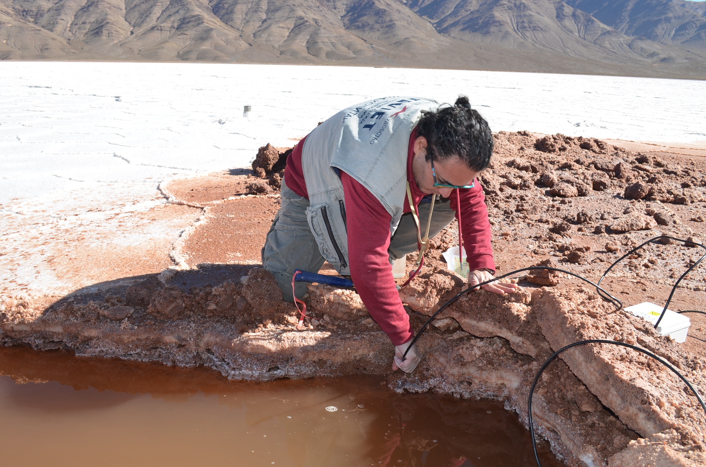
The geologist and student of the Master in Remote Sensing at U. Mayor, José Lattus carried out between May 28 and 29 the data collection for his degree project "Dynamics of an highland salt flat through electromagnetic scattering models using orbital radars" in the Pozuelos salt flat, located in the Puna Salteña in northern Argentina.
The objective of the research is to evaluate the capabilities of a two-layer scattering model, based on SPM (Small Perturbation Method), to relate the SAR backscattered signal to the surface and subsurface configuration of the Pozuelos salt flat. The baseline information is collected through a five-year (2018-2022) multi-temporal analysis of Sentinel-1 (C-band), ALOS-2/PALSAR-2 (L-band) and SAOCOM (L-band) satellite images.
The importance of the study lies in the fact that the Andean altiplano shared by Argentina, Bolivia and Chile contains nearly 60% of the planet's lithium reserves, a soft metal considered strategic and fundamental for the transition to an economy less dependent on fossil fuels.
On the other hand, the use of remote sensors allows for obtaining information from the Pozuelos salt flat by means of satellite platforms, providing a regional or district vision of the study area, reaching remote and hardly accessible areas, thus minimizing field campaigns.
The degree project is directed by Dr. Matías Barber, researcher of the Quantitative Remote Sensing Group of the Institute of Astronomy and Space Physics CONICET- University of Buenos Aires in Argentina and co-directed by Dr. Dražen Skoković, researcher of the Global Change Unit of the Image Processing Laboratory (ERI) of the University of Valencia in Spain and Waldo Pérez, director of the Center for Earth Observation Hémera, all professors of the Master in Remote Sensing U. Mayor.